
We might think that a place called the Hells Throat is an arid corner that suffers from extreme temperatures throughout the year and where life is difficult. However, nothing could be further from the truth. Located in Valle del Jerte, province of Cáceres, lhe Garganta de los Infierno is an orchard where you can enjoy nature in all its splendor.
This place is protected under the figure of the Natural Reserve, which cares for spaces that, due to their uniqueness or importance, deserve special protection and appreciation.
Origin of the Hells Throat
The area was formed in a large granite batholith that is 200 million years old. The altitude variations that we find here (Castifrío 2.308 meters, Cuerda de los Infiernillos 2.244 meters and Cerco del Estecillo 2.290 meters) result in three very characteristic ecosystems: the deciduous or hillside forest, the riparian forest and, finally, the alpine or high mountain ecosystem.
In turn, this mountainous enclave gives rise to the appearance of different streams and gorges that flow into the Jerte river: on the one hand the slope of the Garganta de San Martín and on the other that of the Garganta de los Infierno, which receives water from the Garganta de la Serrá, Asperones and Garganta Chica or Collado de las Yeguas.
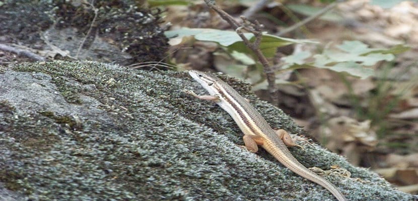
Precisely, The Hells Throat was declared a Natural Reserve in 1994 as it is an area of special importance for wildlife and with geological features of great interest. In this way, to get to know the environment you can do all kinds of outdoor activities such as hiking, bird photography or agrotourism.
Routes through the Throat of Hell
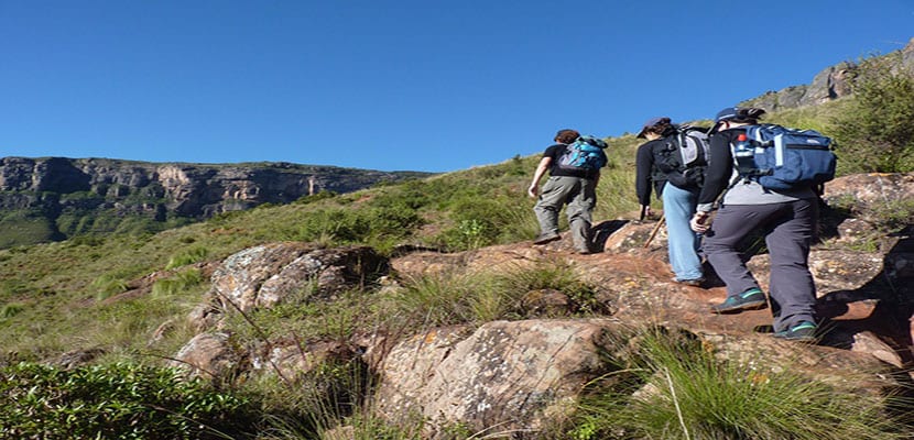
In order to get to know this natural reserve, several routes have been created. It is recommended to always carry them out in the company of monitors or guides to avoid getting lost in the field or accidentally causing damage to the environment due to simple ignorance. The duration can depend on many factors, including the difficulty and the time, as there are routes that range from 5 hours to more than 8 hours.
Low difficulty route (duration: between 4 and 5 hours)
ROUTE: Jerte Interpretation Center - Los Pilones - Puente Nuevo - Interpretation Center
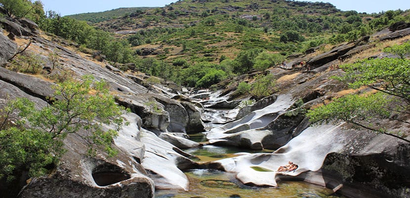
This route takes us to know the heart of the Garganta de los Infierno Natural Reserve, starting from the Jerte Interpretation Center, skirting the lower section of the gorge until reaching the section known as "Los Pilones", where we can enjoy the surprising forms that erosion has formed in the granite rock. Starting from "Los Pilones" you skirt the side of the mountain until you reach the Puente Nuevo, from where you can take beautiful pictures. From this point, you can ascend to Collado de las Losas and return to the starting point along a forest track.
Medium difficulty route (duration: 7 hours)
ROUTE: Interpretation Center - Los Pilones - Carrascal Bridge - New Bridge - Bosque del Reboldo - Interpretation Center
SIt is a very complete tour of the Garganta de Los Infierno, which takes us to know the Interpretation Center, the Garganta de los Infierno, Los Pilones, the Fishermen's Refuge, the Colado de las Yeguas Gorge to see the waterfalls, the traditional houses of the old goatherds who lived in the Valle del Jerte mountain ranges and centenary trees among many other things. Crossing the Puente del Carrascal, hikers can go to Puente Nuevo and then ascend to Collado de las Losas. A must-see is the Bosque del Reboldo, one of the largest chestnut forests in Europe. Finally you will return to the starting point.
High difficulty route (duration: all day)
High Extremadura crossing: Port of Tornavacas - Guijo de Santa Bárbara
This tour takes the visitor to know the highest peaks of the Garganta de los Infierno. From here you have the most impressive views of the Jerte Valley. Due to the difficulty of the route, it is not recommended for those who have little physical preparation, due to its long duration on rough terrain.
Tips for hiking
Prepare the route
Although it may seem obvious, when it comes to hiking it is essential to find out about the characteristics of the route: know where it starts and where it ends, how many kilometers it costs, how long it takes to complete the route, what is the level of difficulty of the route and if it is in good condition throughout its journey. It is not advisable to undertake a route without being clear about these factors.
Weather information
It is also very important to know if the weather will be favorable on the day we plan to go on an excursion.. There are meteorological conditions that prevent hiking and others that, although they make it difficult, are not an obstacle if the appropriate measures are taken.
Hiking equipment
For hiking, the ideal is to wear comfortable clothes that allow all kinds of movements as well as footwear suitable for the mountains. that is waterproof and holds the skin well. In addition, you have to go prepared with some warm clothing in case a change in temperature surprises us in the middle of the route.
On the other hand, a trekking pole is an essential accessory when hiking although many believe otherwise. The cane helps maintain balance, reduces fatigue and the risk of sprains. As if that were not enough, it helps to dispel weeds in the less well-kept areas of the route.
Food during the route
For any ride, regardless of its duration or difficulty, We must bring at least a liter and a half of water or isotonic drinks. It is recommended to drink small but continuous sips. You should never wait to be thirsty because dehydration causes disorientation, as well as jerks, fainting, fainting and in extreme cases even death.
As for food, it is always recommended to eat something light during the excursion such as nuts, energy bars, fruit, cookies or a snack.