
Today I am going to detail the ascent to Pedraforca, one of the best known and most emblematic mountains of the Catalan Pyrenees. A totally recommended excursion for lovers of mountaineering and nature.
Pedraforca is a mountain located in the Beguedá region (Barcelona province) and specifically in the Serra del Cadí (Cadí i Moixeró Natural Park), in the Catalan Pre-Pyrenees. It has two main outstanding peaks, the Pollegó Superior (with a height of 2.506 m) and Pollegó Inferior (2445 m).
It was officially protected in 1982 and owes its name to the material that makes it up and the horseshoe shape of its mountains: Pedra is stone in Castilian and Forca is horseshoe.
It is a one-day ascent but demanding at some points along the route. From November to May Pedraforca is snowy, so make sure you go up at a safe time or with the right clothes and shoes.
How to get to Pedraforca?
The ascent to Pedraforca can be done from many points, surely the best known are from the town of Gòsol and from the Lluís Estaen high mountain refuge. I'm going to tell you about the excursion from the refuge and crossing the Coll del Verdet.
To get to the shelter we first have to go downnational highway C-16 that connects Manresa and Berga with Puigcerdà, Cerdanya and the Catalan Pyrenees through the Cadí tunnel. If we drive north we have to cross the town of Berga, then Cercs and its thermal power plant and before reaching Guardiola de Berguedà we will see a crossroads on our left that indicates Saldes, Gòsol and Pedraforca by the regional road B-400.
We will circulate some 15 km along this road until reaching Saldes, we will cross the town and after approximately 1Km we will see the detour to the right towards the Lluís Estassen refuge. 2Km more along this local road until we reach the refuge parking area, where our excursion will begin.
If you want to stay in the refuge, the road reaches it although it requires a 4 × 4 car, the asphalt is not very good. Otherwise I do not know if you can get there by car without more. Personally, it gave me the feeling that it was not possible, everyone left the car parked below and did this first part on foot, it is about 15 minutes of gentle climb.

The ascent to Pedraforca
The ascent to Pedraforca requires only typical mountain clothing and footwear in principle. If the excursion is carried out in winter, there will almost certainly be snow, so if we choose to finish it, we should consider bringing snow shoes and help tools for ice.
Once parked in the authorized parking area we will take the path that will take us to the Estassen refuge, about 15 minutes on foot through lush forests of black pine and fir, typical of the area.
Once in the refuge we can go up to Pedraforca by two main roads, through the scree (known in Catalonia as tartera) or by the Coll del Verdet. I recommend you go up through Verdet and go down (if possible) through the scree. Due to the large number of hikers who have made the descent through the scree, it is currently very slippery, you can still go down it. I would ask the refuge staff or experienced mountaineers if their condition is correct for the descent.
Having said that, we will take the Verdet path and begin to climb. In total, the ascent along this route should be done in about 3 hours from Estassen approximately, the accumulated unevenness is about 1000 meters from the parking area.
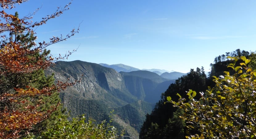
The first part passes through lush forests and the slope is gentle, we will zigzag the mountain. Little by little the slope will grow and the landscape will change completely from large trees to imposing rocks and gorges. When we have been uphill for approximately 1 hour, the path will already circulate following the profile of the mountain. On our left we will see the Pedraforca peaks and on our right 1000 meters of unevenness and part of the Berguedà and the Pyrenean systems.
At all times the path is perfectly indicated and at a certain point it will tell us to turn left towards Verdet. At this point the slope is already starting to be considerable.
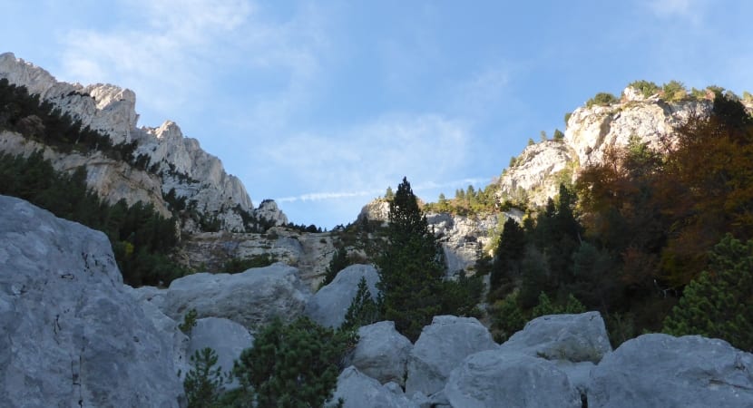
After a few minutes we will arrive at Coll del Verdet, a point between mountains and that connects the path we are following with those who come from Gòsol.
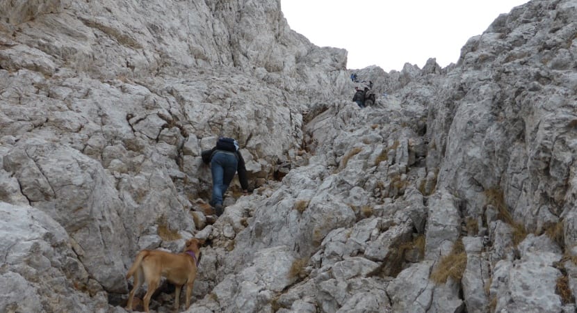
From here the real ascent begins, the first minutes are quite easy through rocky terrain typical of the area. The second part, probably the most difficult, has a very steep incline. The path, already blurred, has ropes so that people can do it without problems. Here we will no longer walk, we will crawl and we will almost climbThe ascent is complex but in theory every hiker can do it.
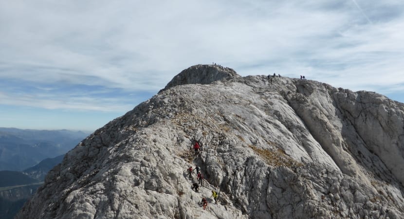
The third and last part is easier than the previous one but still has a remarkable physical demand. Now only a final descent and a final climb through rocky terrain will remain to reach Pollegó Superior, the highest point of Pedraforca and our final objective.
From here we can decide if we undo the road to get back to the car or if we go down the scree between the two «Pollegons». If we go down there we will go faster but it is a bit dangerous and slippery, see if people go down without difficulty and if the weather is good.
Surely and as the title of the article indicates, the excursion and ascent to Pedraforca is one of the mythical and emblematic routes of the Catalan geography, totally recommended.