
Do you like to go for a walk, long walk, ride a bike? Well that's what this proposes green Way, Path of the Bear, that runs through the lands of Principality of Asturias, in Spain. A beautiful path that can be done practically all year round and that precisely changes its colors each season.
It's a old mining road which at the end of the 80s took on a new meaning and became the engine of the economic revitalization of the area, making it more attractive for both locals and temporary visitors. Let's see then what the beautiful and Asturian woman offers us Path of the Bear.
The Path of the Bear
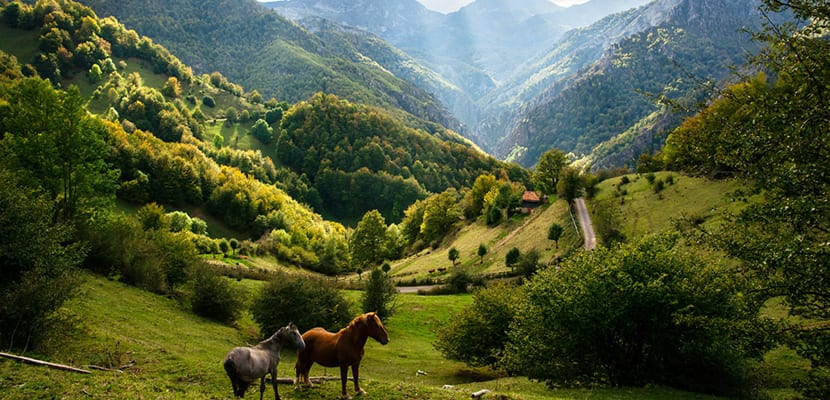
As we said, this road is in Asturias, a principality, autonomous community, which is northwest of Spain. It is inhabited by just over a million people and its capital is the city of Oviedo, although Gijón is the most populated urban center.
The path is a old mining road, that is to say, a path that formerly traveled the train of the mines that crossed the valley of the Trubia river, going and coming from the Teverga mines, of coal and iron. The train It was only in use from the 60th century to the early XNUMXs and the transportation was exclusive to the mines, no people traveled. Obviously, when the mines ran out of production and stopped being competitive, they closed. This happened in 1963.
This little worker train began its journey in the town of Trubia, a large supplier to the local arms factory, crossed the Trubia valley, reached Villanueva and from there it reached Proaza and then Caranga. At that point it forked: one section reached Bárzana and Santa Marina and the other ended at Entrago. For many years it was forgotten but in the late 80s interest in it was rekindled.
Thus, In 1987, local governments were thinking about how to revitalize economies in the hands of rural tourism and the old train was presented as one of the most important tools to achieve it. The train already linked the territory, so it was only necessary to recover it, put the value of the route and add more attractions to the route.
The first works were of a more technical nature because after decades of abandonment the train was in not so good condition. We are talking about the track, the platform, so that it could be adapted to new sports uses or to the feet of tourists.
While these were developing, the different municipalities began to draw cultural, social and sporting programs and events that they could take advantage of. We talk about paragliding tournaments, marathons, horseback riding, bike lanes, hiking, climbing, piper encounters, etcetera, etcetera, etcetera.
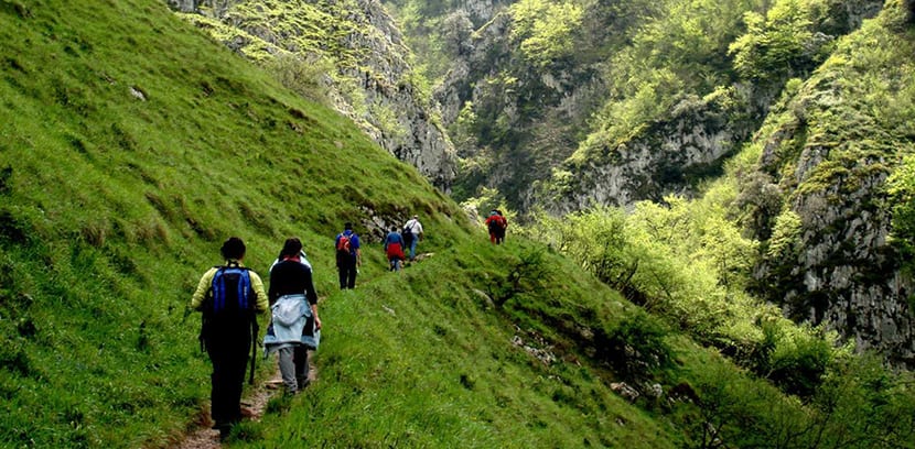
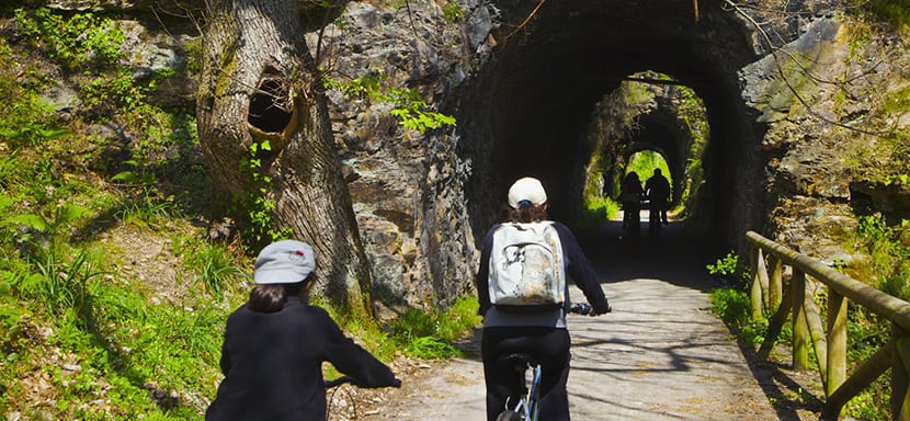
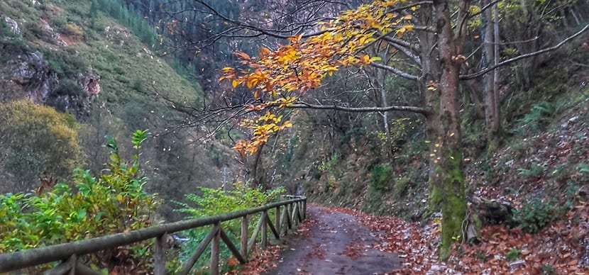
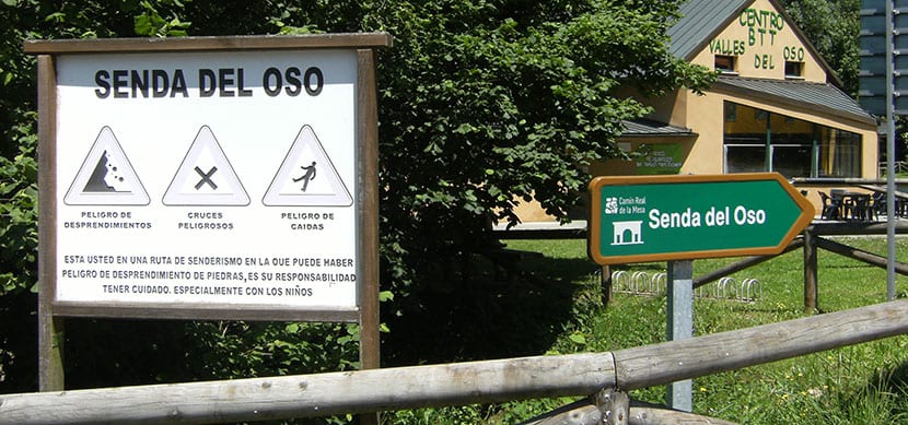
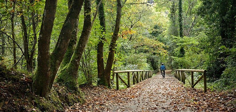
Thus was born the Path of the Bear, which It is also known as the Bear Route. It is thus a pedestrian and cyclotourist path in which even can be circulated in a wheelchair. Travel more than 40 kilometers and it is ideal to do with children. Have information panels well located, there are wooden fences protecting the most dangerous sections and the ground is firm and well compacted. It is a classic greenway.
What is a greenway? It's a pedestrian and cycling route in a natural environment which focuses on the refurbishment of disused structures, old roads or old railways, especially. Green Way they are told in Spain and it is synonymous with security, ease and accessibility. Also places of meeting, recreation, well-being and good quality of life. If you are interested in knowing others, I will tell you that in Aragon, Andalusia, Madrid, Castilla La Mancha, Catalonia and Mallorca there are other greenways.
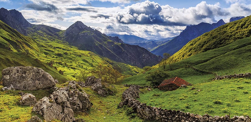
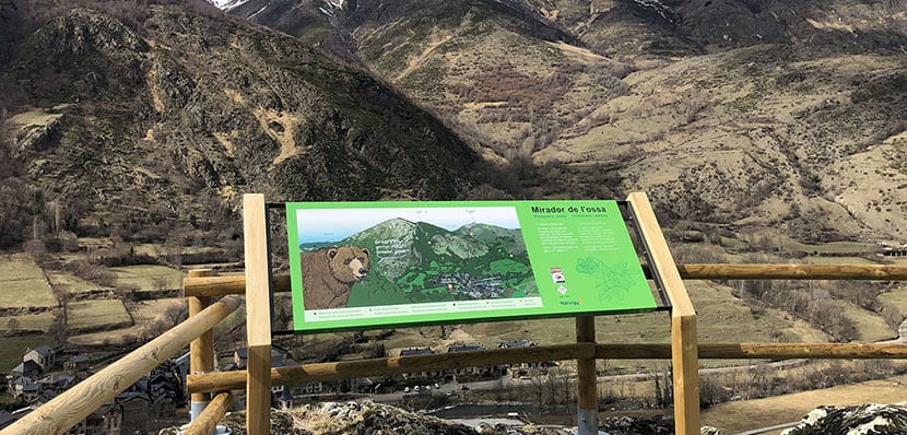
Specifically the Path of the Bear is shaped like the letter Y and as we said above, it begins in Tuñón, in the recreational area, in San Adriano. A common 10-kilometer stretch crosses Proaza and then separates into two different valleys: the Teverga Valley with an end point in the Huerta caves, and the Quirós Valley with an end in Santa Marina.
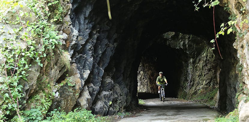
The journey of both is beautiful because includes tunnels, now illuminated, bridges, gorges and industrial ruins. For example, at kilometer 5.5 there are the Osas Tola and Paca, in a fenced bear pit, or we will also see the impressive and beautiful Peñas Juntas or Valdecerezales gorge.
The official website tells us that There are three sections on the Senda del Oso. Tuñón to Proaza, Proaza to Teverga and Proaza to Quirós:
- Tuñón to Proaza: the start is from Tuñón, six kilometers are covered with a drop of 10 meters and the difficulty of the route is low. It takes an average of two hours. It was the first section opened, in May 1995.
- Proaza to Teverga: the distance traveled is 14 kilometers with a drop of 10 meters. The difficulty is also low, although it is estimated that between Proaza and Teverga it takes no less than four hours. It was inaugurated in 1996 until Entrago and later, in 2011, the section until Cueva Huerta was opened.
- Proaza to Quirós: this section covers eight kilometers with a much steeper slope than the previous ones: 450 meters. In any case, the difficulty is low and the time to cover it is four hours. It opened in 1999.
There are two companies that promote adventure sports in the area. This Deporventura with its set of activities: bike and snowshoe rental, caving, canoeing, climbing, camping and, for the more adventurous, canyoning, that is to say, descent through a riverbed crossing waterfalls, jumping pools and sliding down stone slides.
On the Senda del Oso there is also the Llano Refugea climbing school which belongs to the Mountain Federation of the Principality of Asturias and is in the Quiros Valley, in the village of El Llano. The school offers climbing courses, family climbing and other collective courses and activities.
As you see, the Path of the Bear is offering us activities and postcards throughout the year. How about taking a walk and enjoying the nascent spring there?