
All the Canary Islands they are an archipelago over the Atlantic Ocean. They are northwest of Africa and in total there are about eight islands, five islets and eight rocks. We speak, for example, of La Gomera, La Palma and Tenerife, El Hierro, Fuerteventura, Lanzarote and Gran Canaria.
But how the canary islands were formed? What was the wonderful process by which they were born?
How the Canary Islands were formed
The islands are of volcanic origin and they are on the African plate, so it integrates the region known as Macaronesia. They have a subtropical climate, with some climatic variability that translates into biological Diversity.
All the islands have biosphere reserves, national parks and areas declared World Heritage Sites. Before the pandemic, the islands were visited by millions and millions of people, for example, in 2019 it is estimated that they had 13 million visitors.
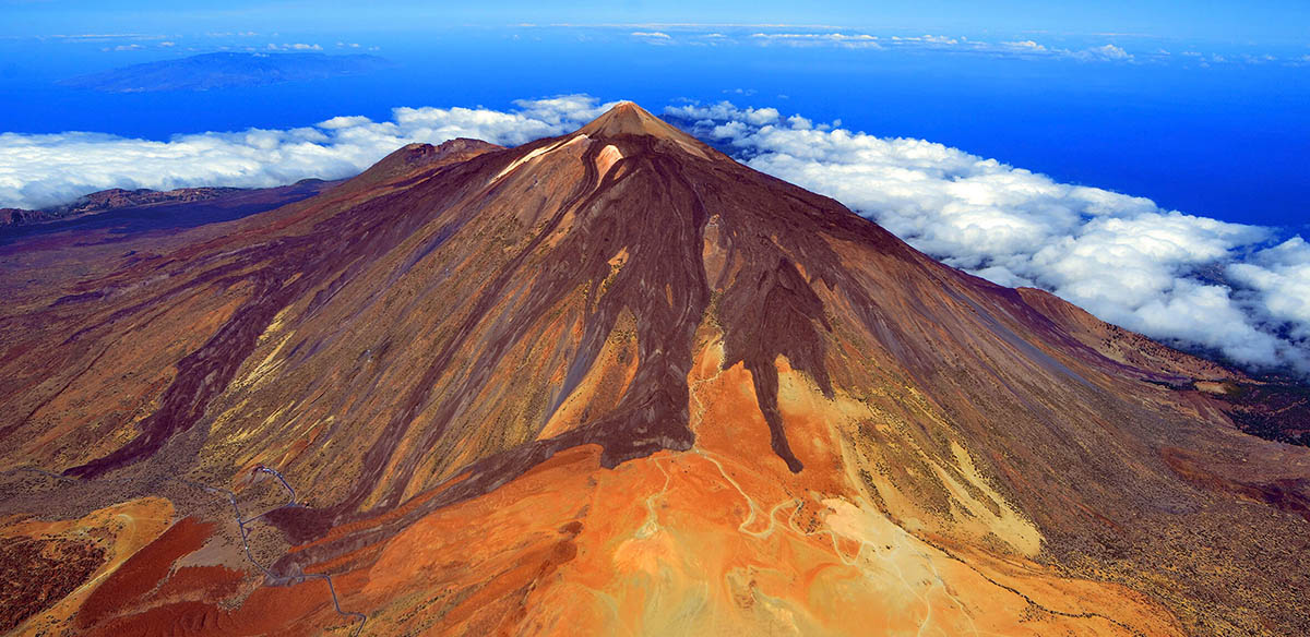
It is also calculated that its volcanic origin is, in terms of the age of the Earth, quite recent: 30 million years There are several theories that claim that the formation of the islands had different periods or volcanic cycles which involved a constant process of lava emergence and successive solidification.

Thus, each island in the group can be said to have its own geological history or antiquity and probably the oldest islands are Fuerteventura and Lanzarote, with Tenerife, Gran Canaria and La Gomera behind. More recently would be La Palma and El Hierro, barely 2 million years old.
So what would this process or cycle have been like? First, a phase called Basal Complex took place, in which the oceanic crust fractures and blocks rise in which lava from submarine eruptions was deposited. Then the islands emerge from the waters in the phase called "Sub-Aerial Construction".
Here there are in turn two cycles, first the old series in which the great volcanic buildings are created, and then the so-called recent series that today remains and in which the characteristic is the permanent volcanic activity. In short, we can imagine magma from the interior of the planet ascending through various cracks in the crust, accumulating on the seafloor and then emerging at sea level.
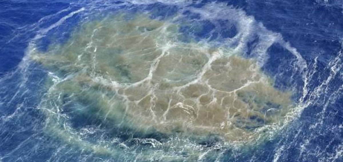
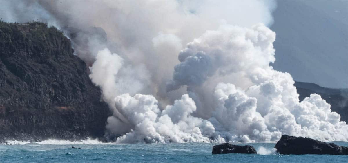
Esto it was like this for millions of years, and as we said, continues to this day with water vapors, sulfurous gases and eruptions from time to time. For example, the eruption of Teneguía on the island of La Palma in 1971 or the most recent, in 2021, when the unnamed volcano terrified the island for long 90 days.
The Canary Islands are, in their own way, mysterious, since they form one of the few archipelagos that were formed by marine volcanoes that are still active, so for scientists they are super interesting. are counted at least 18 eruptions in 500 years so it's got a pretty intense volcanic story and yes, we haven't seen the end of it yet.
The particularity of the islands has inspired several theories regarding their formation. For a time he prevailed hot spot theory according to which the islands originated in the transoceanic trench between Africa and America. This is how the islands appear in a trail, the oldest being the ones that are farthest from their origin as they move along the lithospheric plate.
Another theory was propagating fracture theory, according to which, along with the compression and distension cycle of the Atlas tectonic plate, there was a fracture in the lithosphere that spread from the continent to the Atlantic, leaving magma in its wake, lowering the pressure and allowing it to emerge at to the surface.
It must be said that these have been theories and have not been fully accepted, although the hot spot theory is more popular. This would explain why the islands are still active, except for some that, at the moment, do not register volcanic activity. Yes, yes, this explanation still has its holes but scientific investigations continue to try to answer all the questions.

Then, What characteristics do the beautiful and dangerous Canary Islands have? well they have one great diversity of volcanic rock covering the entire spectrum of alkaline basalts, there are all kinds of craters, are very asymmetric depending on where the wind blows from, which guides the magma in one direction or another, in addition to the pyroplastic explosions and bombs, and there is also various magmas on the islands and multitude of volcanic structures between cones, strata, craters, calderas...
On the other hand, the islands enjoy a pleasant subtropical oceanic climate, with trade winds, due to the proximity of the tropics and the current of El Golfo. The winds push the clouds forming those beautiful seas of clouds that also give the sensation that the waters of the sea are almost spongy and very calm.
Canary Islands is a paradise with an average temperature during the year of 25 ºC and that is why at the tourist level it is a phenomenon.
Left practical information about the most important islands:
- The Palm: It has 708.32 square kilometers and a population of 83.458 thousand inhabitants. The Teneguía volcano has it bad, but last year there was another eruption that caused havoc. It is the second highest island in the group, with its highest peak of 2426 meters, Roque de los Muchachos. It has the largest optical telescope in the world, the Gran Telescope Canarias with a mirror of 10, 40 meters in diameter.
- El Hierro: It is the smallest island with its own administration: 268.71 square kilometers and only 11.147 thousand inhabitants. It is a Biosphere Reserve and a major underwater eruption took place a decade ago. It is the first island in the world to supply itself with renewable energy.
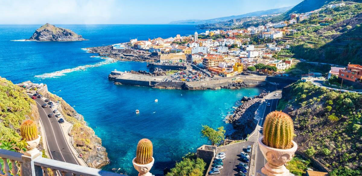
- Tenerife: It is the largest island, with 2034.38 square kilometers. It is also the most populated with 928.604 thousand inhabitants. She is known as the "island of eternal spring", has beautiful beaches and many natural parks. And yes, it is the one that receives the largest tourist affluent per year.
- Gran Canaria: It is the second island with more inhabitants in the group. It is 1560 square kilometers in area, round in shape, and has many mountains. Have archeological sites of value and varied landscapes, from golden beaches, through desert landscapes to very green areas.
- Fuerteventura: It has 1659 square kilometers and is the closest to Africa. It is also the oldest from the geological point of view and the most eroded. It is a Biosphere Reserve since 2009.
- Lanzarote: It is the easternmost island and the oldest of all. It has 845.94 square kilometers and its capital is Arrecife. It has volcanoes and has been a Biosphere Reserve since 1993.
- The Graceful: until very recently it was known only as an islet, but today it is an island, the eighth inhabited island of the group. It is barely 29 square kilometers and is inhabited by 751 people.