
El Tablas de Daimiel National Park It is a wonder of nature located in the province of Ciudad Real, belonging to the Autonomous Community of Castilla la Mancha, relatively close to Madrid. It was declared as such in 1973, as well as a Biosphere Reserve in 1981, and included in the Ramsar Convention a year later.
It is also a Special Protection Area for Birds since 1988 and we would dare to tell you that it is a unique ecosystem. It occupies a total of three thousand thirty hectares within the municipalities of Villarrubia of the Eyes and his own Daimiel, which gives it its name. To encourage you to get to know this wonder, we are going to explain in depth what the Daimiel Tables are.
Daimiel Tables: Concept and characteristics
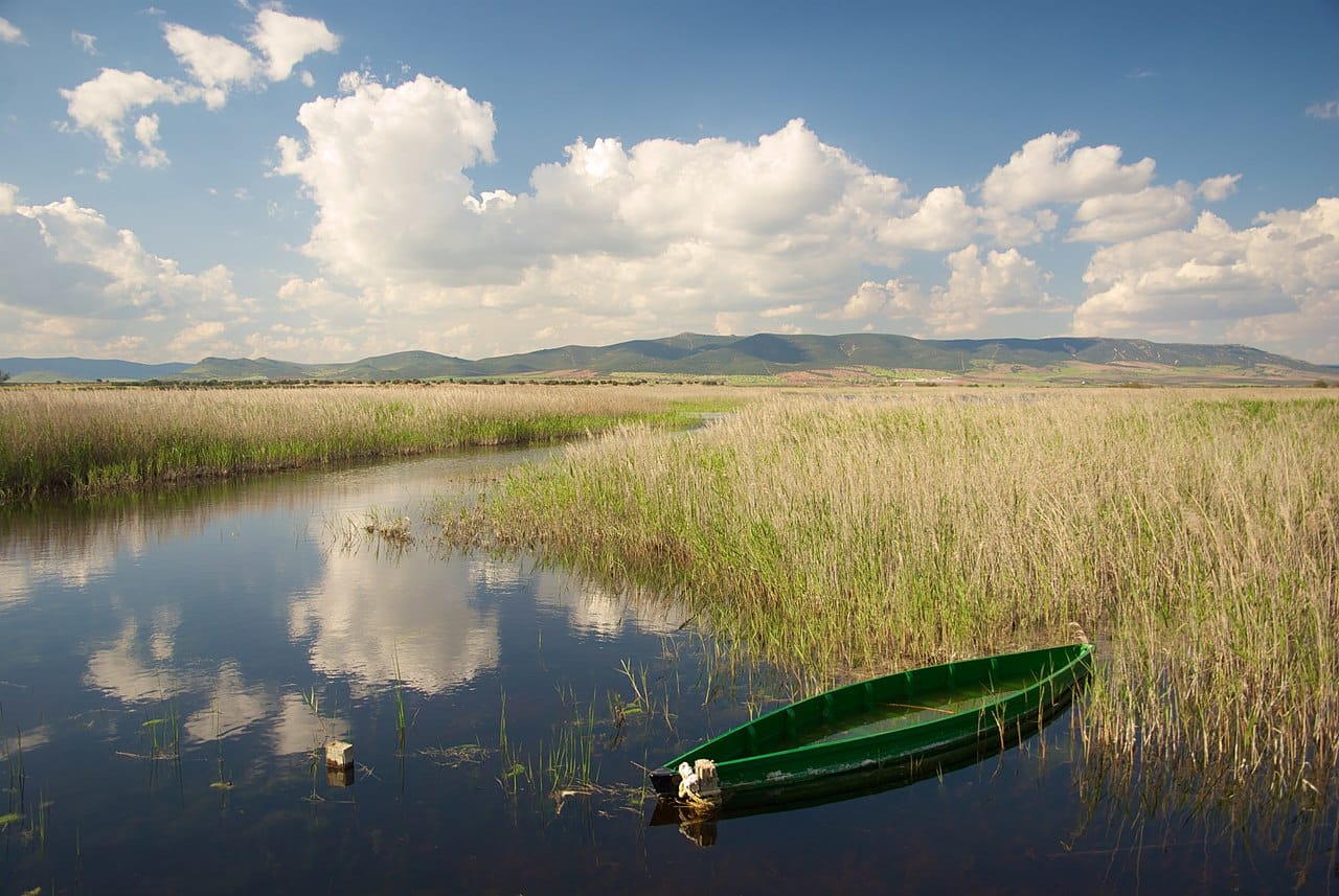
Panoramic view of the Tables of Daimiel
It is one of the last representatives of the calls river tables. This name is given to the overflows of rivers that originate both from the lack of slope of the land and from the semi-endorheism. In turn, it is called endorheic to a space in which the water has no outlet to the sea. It can only disappear by seeping into the soil or by evaporation.
Although it is not the case of the Daimiel Tables, if the evaporation is greater than the water supply, salt flats are formed. Examples of endorheism are Caspian Sea and Dead Sea, which, despite their name, are lakes. However, in the case at hand, the waters have remained in most areas.
In the Tables, the rivers that make them up are the Guadiana and its tributary the stilt. The first is well known, so we don't need to tell you about it. But the Cigüela is the other great vitalizer in the area. It is a brackish water river that, in turn, is fed by tributaries that join it between Socuélamos y Inheritance. Its the Riánsares, the Záncara, the Córcoles and the Amarguillo.
But, returning to the drying up of these lands, the Tables are in enormous danger because of the mob. This kind of mineral coal is formed by conversion of certain plant species, which are carbonized. But more important than dwelling on scientific concepts, is to explain how it affects the Daimiel Tables.
conservation problems
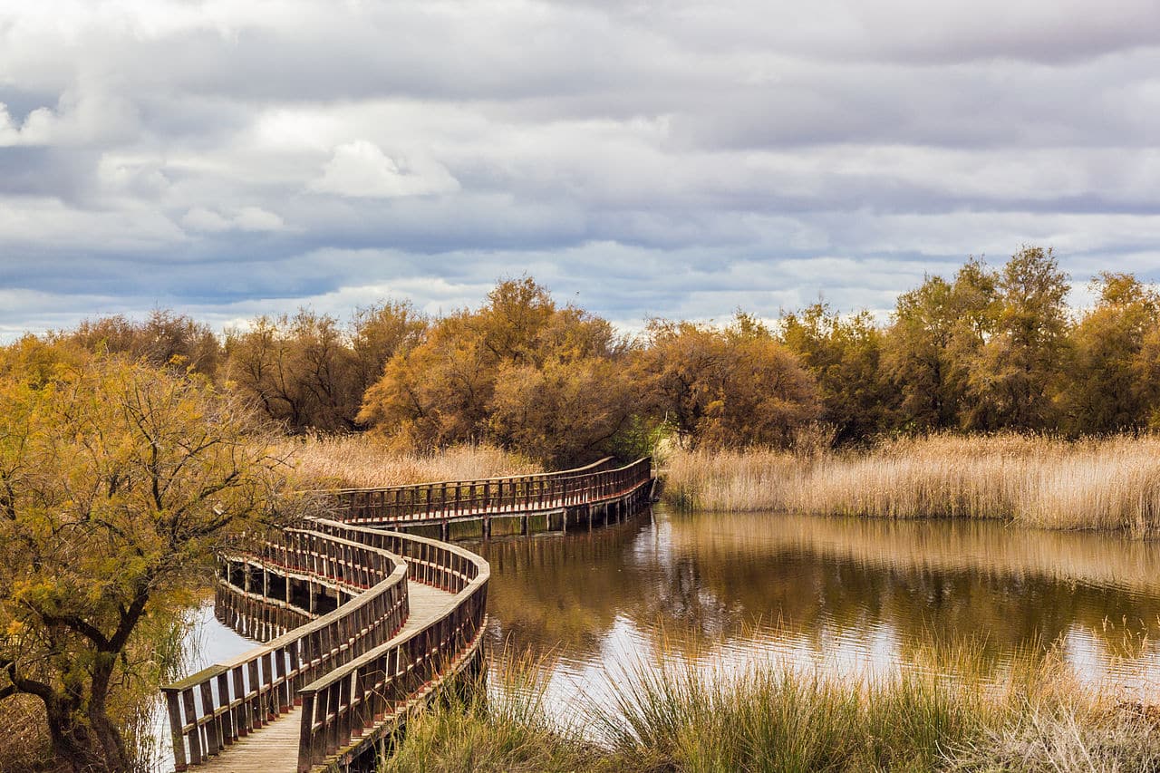
One of the Daimiel Tables routes
As we told you, peat is a mineral carbon that is formed by carbonification of the fluvial vegetation of an area. This occurs in the Tables. But the most serious thing is that the mobs, when the land dries up, they are catching fire spontaneously. When this occurs, they shrink and cause the ground to crack, which favors the entry of oxygen that fan the fires y expels noxious air to the surface.
But, above all, the fire in the peat bogs causes the floors lose impermeability. And with it, what the aquifers disappear absorbed by the earth. Due to all this, the situation became critical around 2009. To avoid disaster, a a transfer of water from the Tagus river a year later. It also coincided with a time when it rained a lot.
All this contributed to the filling of all the floodable areas of the Tables with water. This put out the fires and since then the situation in the park has improved a lot. In fact, the water level of the aquifer has risen by around twenty meters. However, environmental organizations have pointed out that the Daimiel Tables have not yet been fully recovered and that, if measures are not taken, the previous situation could recur.
Flora of the Daimiel Tables
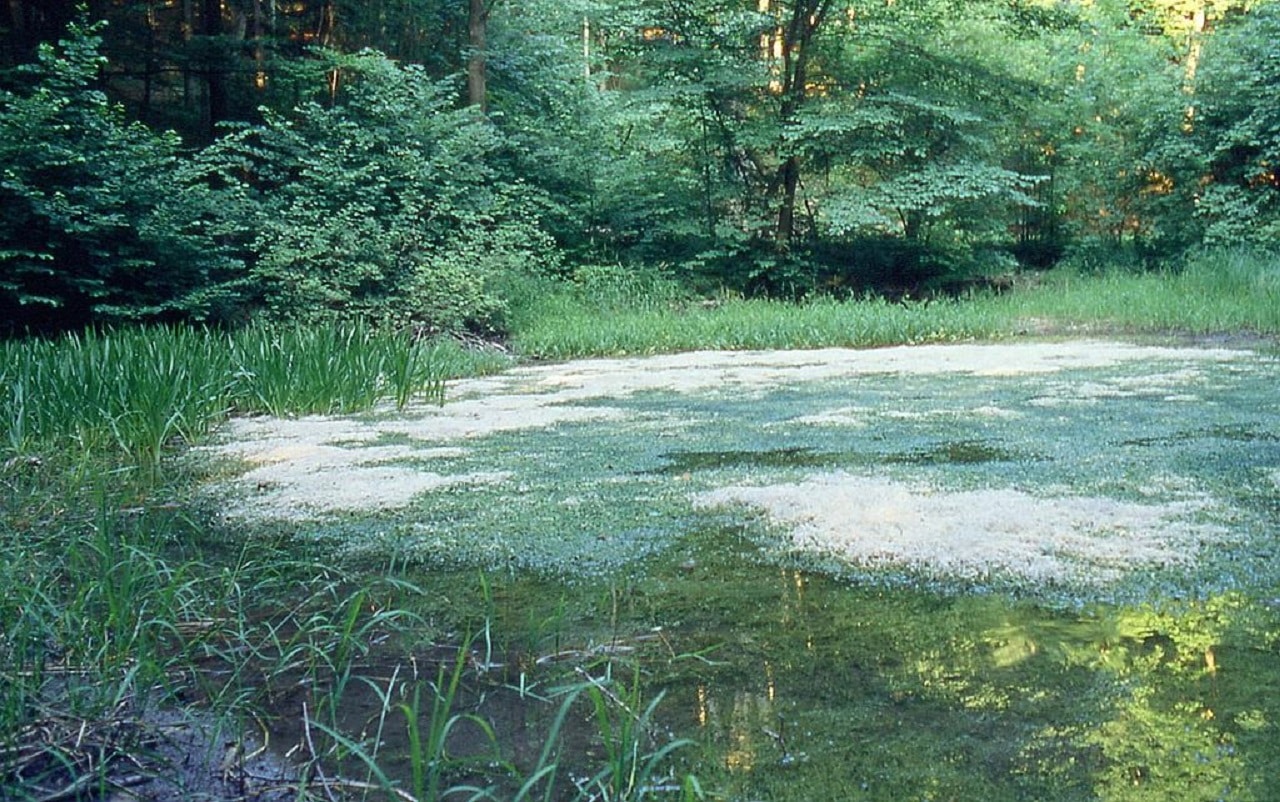
chara wetland
The peculiarity of an ecosystem as singular as that of Las Tablas means that this natural park has a characteristic flora. This is the result of silty and peaty soils, seasonal and saline waters, as well as extreme weather. It is made up of a total of more than three hundred species of plants.
In the Guadiana part, there are areas of riverside forest, with willows, black and white poplars or brambles. On the other hand, further north, on the banks of the Cigüela River, there is Mediterranean forest, with large hundred-year-old holm oaks, but also meadows of legumes and grasses, which serve as pasture for sheep.
However, perhaps the most representative species of the park is the masiega because it develops well in peaty soils. If you don't know what this plant looks like, you will recognize it by its elongated leaves and spike-shaped flowers. In turn, it is grouped into meadows called masegars. And, next to it, you can also find in the Tables areas of reed, cattail, limonium, calamillo or marshmallow.
As for the flooded areas, they abound the seaweed. Specifically different kinds of Chara, which combine with other aquatic plants such as the buttercup and the veronica. These algae have enormous ecological value and even serve as an indicator of the health of the waters because they are very vulnerable to contamination and eutrophication. The latter implies that harmful inorganic nutrients abound in excess because they contain a lot of nitrogen and phosphorus.
The fauna of the park
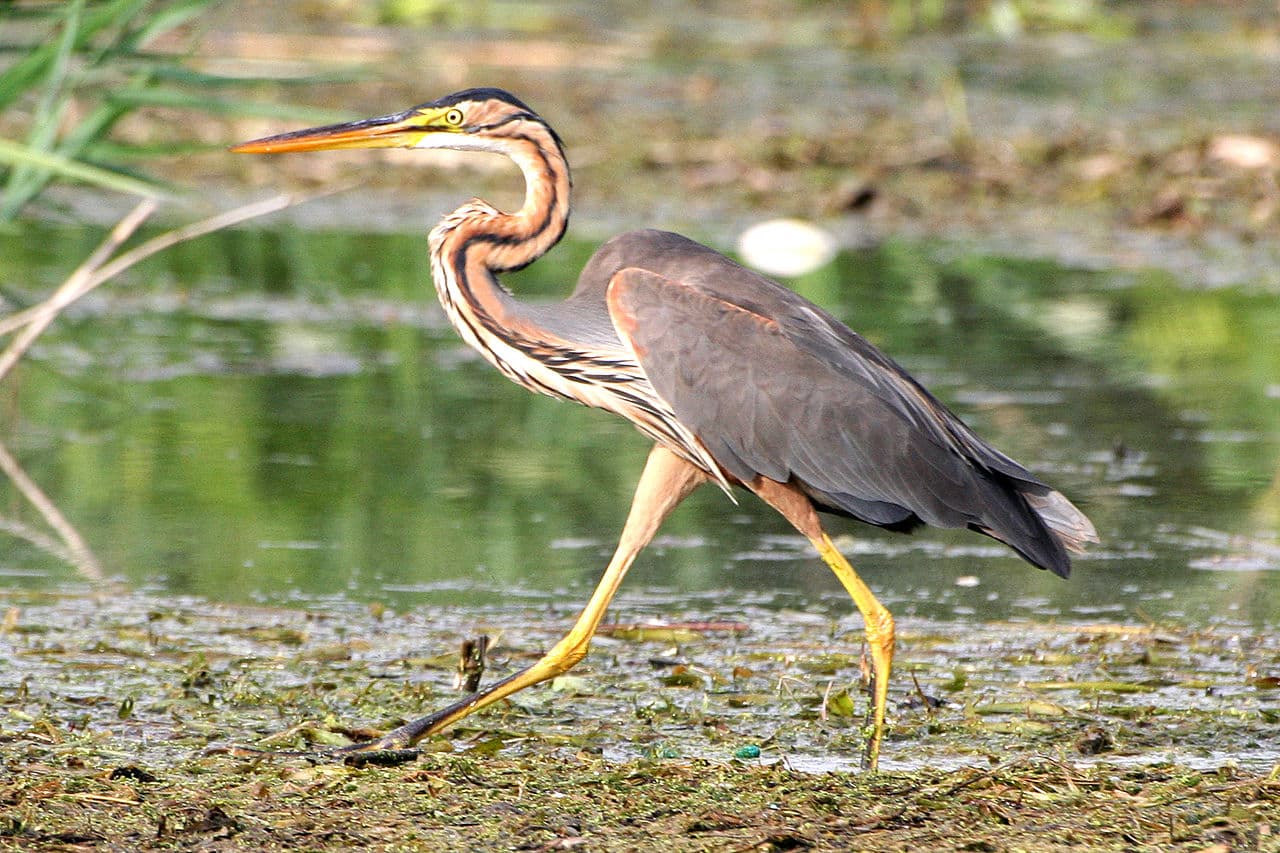
A specimen of heron, the most abundant bird in Las Tablas
This park is considered the wetland with the richest fauna from the center of the Iberian Peninsula. We have already told you that it is listed as Special Protection Area for Birds. This is due both to the bird species that live there permanently and to those that nest during their migrations.
Among them, the population of herons, above all, of subspecies such as the little bittern and the cattle egret. But there is also a large number of loons like the common grebe and ducks such as the azulon or the frieze duck. Also, you can see rallied such as the common coot or the European rail, moustaches, buntings and bastard nightingales. As for the birds of prey, there abounds, above all, the western marsh harrier.
Regarding mammals, you can find species such as the fox, the rabbit and the hare, the wild boar or the otter. If we talk about reptiles and amphibians, you have different frog species, the viperine snake and the necklace snake, ocellated lizard y galapagos like the European and the leper. Finally, there are plenty of fish like the carp, the gambusia, the percasol and the cachuelos, which coexist with invertebrates such as the River crab.
How to visit the Daimiel Tables
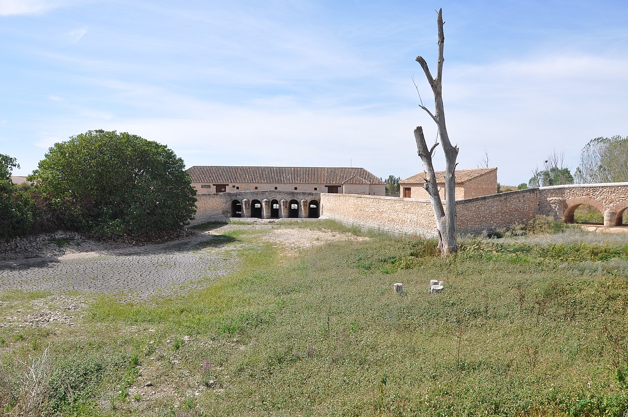
Molemocho Mill Visitors Center
After describing what the Tables of Daimiel are, their problems and the flora and fauna that you can find in this park, we are going to explain how to meet him. First of all, you should know that there is two visitor centers. The main one is open from 9 a.m. to 19 p.m. in winter and from 9 a.m. to 21 p.m. in summer every day of the year. In it, you will find information about the park, but also a kind of museum with reproductions of species that inhabit it, photographs and even audiovisuals. And in front of him there a store where you can buy handicrafts, gastronomic products and souvenirs of your visit. They even let you rent some binoculars.
The other visitor center is the one with the Molemocho mill, which is one of the oldest hydraulic flour mills in all of Castilla la Mancha. In it you will find information about the relationship between the Tables and the people who have inhabited them since ancient times. Likewise, both in one center and in another they will offer you information about the different itineraries you can do in the park.
You have the option of visiting on your own, but we advise you to do so accompanied by a guide. There are several professionals and they accompany both schoolchildren and organized groups and families with children. In any of the cases, there are various itineraries established by the park authorities.
There is a route in 4 x 4 that runs through a good part of the southeastern shore, with areas such as motillas, abandoned islands o the fishermen's huts. Depending on the season, it also includes the northeast, where you'll see pastures. However, we advise you to choose one of the hiking itineraries.
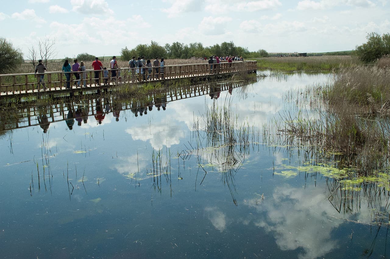
Visitors at the Daimiel Tables
The park offers you three, all of low difficulty and quite short. The from the island of bread is the best known and includes an aviary: the Acclimatization Lagoon. It is a little over two kilometers long and is flat. For his part, he of the Permanent Lagoon reaches the entrance to the Guadiana river park and has two wildlife observatories. It measures a kilometer and a half and starts from the previous route.
Finally, the Prado Ancho Tower itinerary runs through the northern area of Las Tablas. It gets its name from the tower at the end of the route, which offers magnificent views of the wetland. In this case, it is a little longer, since it measures four kilometers, but it is also easy. However, this route is seasonal, since in summer and autumn the area remains dry.
In conclusion, we have explained what are the Daimiel Tables and how you can visit them. We can only tell you that the main access to the park is from the town of Daimiel, by a highway of barely ten kilometers in length. But, to give you a more general idea, you should know that this town is thirty-three kilometers from Ciudad Real, about one hundred and twenty Toledo and 175 of Madrid by highway. Dare to know this wonder of nature.