
Madrid is one of the main access doors to discover Spain. It is the capital, with all that that means, although beyond its urban borders it is also a green paradise.
If the views of Madrid from its skyscrapers or rooftops seem wonderful to you, you cannot miss the ones from the Madrid countryside. That is why we want to present you some hiking routes through Madrid so that you can get to know the nature that surrounds the big city.
Patones de Arriba
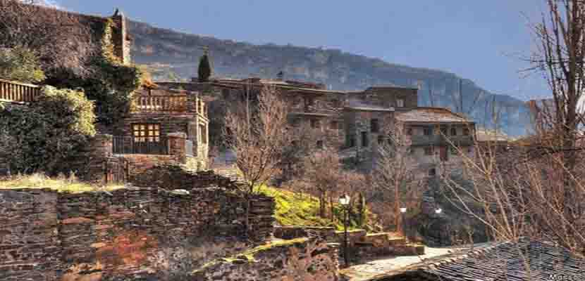
Image | My Cloud
It is said that it is the most beautiful town in the Community of Madrid. A charming town that is said to have once been a kingdom and today is the only remaining "black town" town in the entire province. Surely its location, secluded and almost hidden, has allowed its architecture, way of life and traditions to survive the passage of time.
The most picturesque thing about Patones de Arriba is the unique appearance of its houses, which are part of what is known as «black architecture». A very popular style in some areas of Spain such as Segovia, Guadalajara and Madrid that is characterized by the use of blackboard as the main constructive element, since it was more abundant and economical than others.
Unlike Patones de Abajo, a basically residential municipality, in Patones de Arriba hardly anyone lives and it is mainly a tourist place. Vehicle access is restricted so it is advisable to get up early and arrive early in town if we do not want to run out of space to park in the tiny parking lot.
From Patones de Arriba you can take a circular hiking route that ascends to the summit of Cancho de la Cabeza, its highest point at 1.263 meters. and from which they can glimpse incredible views of the Atazar reservoir, the Sierra Norte, La Pedriza, the Pico de San Pedro, the Sierra de la Cabrera and the town itself. This is one of the hiking routes in Madrid for which you should be well prepared since you will walk around 13 kilometers for about four hours. The landscapes, in which broom, rockrose and lavender abound, are worth photographing.
We can also choose to do two hiking routes through the town framed within the Ecomuseum of La Pizarra., which will tell us about the cultural significance of the architecture of the region and the architecture of the typical foods of the region and the places where they were manufactured (threshing floors, wineries and ovens). Both are marked by explanatory panels.
Another option is to do the ecological path of El Barranco, which is the path that connects Patones de Arriba with Patones de Abajo.
How to get to Patones de Arriba?
From Madrid you can get there by the A-1 taking the exit at kilometer 50 and take the detour towards Torrelaguna on the M-102 until you find the municipality.
Schmidt Road in Navacerrada
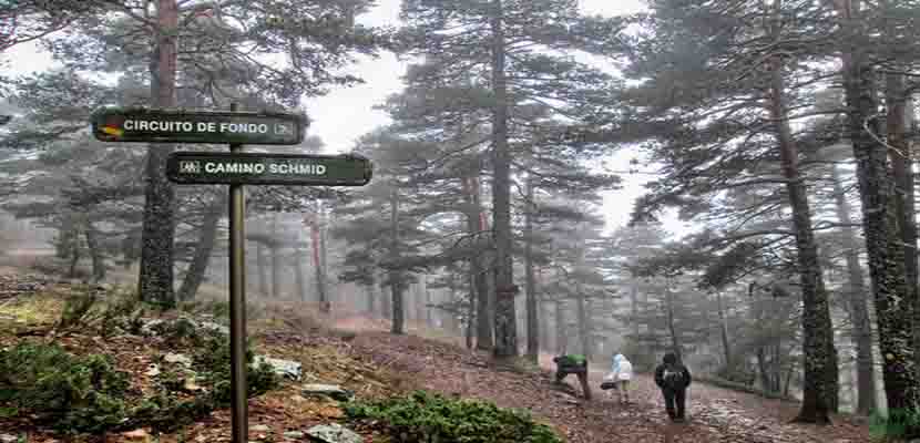
Image | Hiking Madrid
Another of the most interesting hiking routes in Madrid to do is the Camino Schmidt in Navacerrada. This town in the mountains of Madrid is located in the Sierra de Guadarrama National Park, at about 1.200 meters high, and every year it is visited by thousands of people who seek to disconnect from the stressful city to connect with nature.
The Schmidt Trail is one of the most popular hiking routes through Madrid to do in the Sierra de Guadarrama. It owes its name to the hiker Eduardo Schmidt who drew it at the beginning of the XNUMXth century with the aim of joining Cercedilla with the Puerto de Navacerrada.
We are facing a route of low difficulty and 7 kilometers that is designed to be a one-way route. Since it is usually covered with snow during winter, the best time to do the Schmidt Trail is in spring and autumn.
This mountain trail begins at the Puerto de Navacerrada and runs along the northern slope of the Siete Picos mountain range (between Segovia and Madrid) in the direction of Cercedilla, ending at the Peñalara Mountain Club Hostel.
Along the way there are spectacular views of the blurred Castilian plateau, pine forests and mountain streams.
How to get to the Schmidt Trail?
Take the A6 (N-VI) highway to the municipality of Villalba where you have to follow the signs for Puerto de Navacerrada. Once there, to get to the Schmidt path, you have to cross the road and continue along the path that leads to the El Escaparate ski slope, where the path begins.
The World Ball
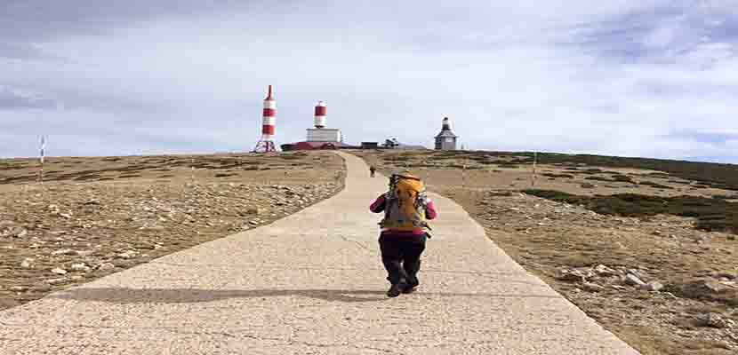
Image | Enjoying Families
In the heart of the Sierra de Guadarrama and within Navacerrada the Bola del Mundo is located, the name by which Alto de Guarramillas is popularly known, at an altitude of more than 2.000 meters.
This is one of the hiking routes through Madrid that have low difficulty. In total there are 11 kilometers that are done in four hours. The route of the Ball of the World can be started from several places but one of the most common is the Puerto de Navacerrada. From here, the route is 8,4 kilometers long if we take into account the kilometers of descent.
As a curiosity, an identifying feature of this mountain are the radio and television antennas that are located on it. They often serve as an orientation for other hiking routes in Madrid as they are covered by a rojiblanco protector that resembles a rocket and makes them easily identifiable.
How to get to the Ball of the World?
By car, take the A-6 to Villalba, where you take the detour to the M-607 in the direction of Navacerrada. By train, take line C9 to Puerto de Navacerrada station. Access will be on foot from the Cercanías-Renfe station to the Puerto de Navacerrada.