
Spain It has beautiful natural settings and one of them is the Canyon del Río Lobos Natural Park, a green and rocky postcard in Castilla y Leon that today we will discover. It is a protected landscape, named a park in 1985, with the aim of caring for the flora and fauna of the place.
Through this beautiful landscape of the province of Soria you can, very especially, do Hiking and for those who enjoy this type of sport, many routes are proposed. Today we tell you everything about this natural park where you can also meet species of all kinds and wonderful caves.
Canyon del Río Lobos Natural Park
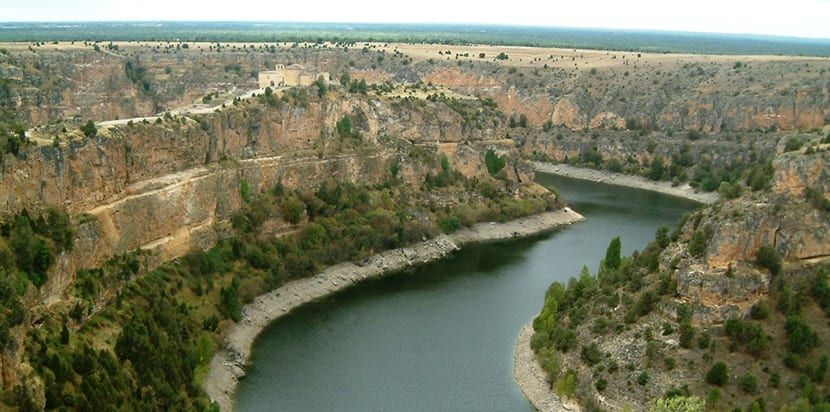
As we said above the park occupies the territory of Soria but also Burgos and its main axis is, of course, the Lobos River, which runs through the bottom of the canyon that over the centuries it has helped to form. The river is born in Burgos, although most of its route is through Soria.
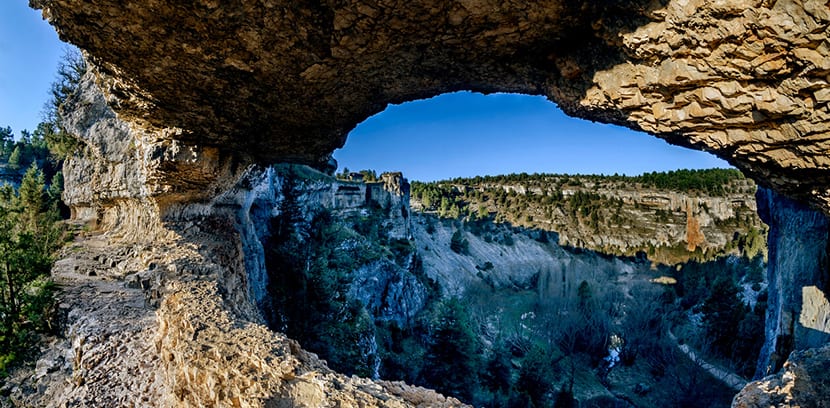
The landscape is a canyon, a very deep gash sunk into the earth with towering walls. The river Lobo is partly the cause of the erosion, its constant flow, but the water has ended up dissolving the rock as well and in the end the caves hidden in the earth have sunk. Thus, areas called lemmas, concave in shape, rusted, on the high walls of the canyon.
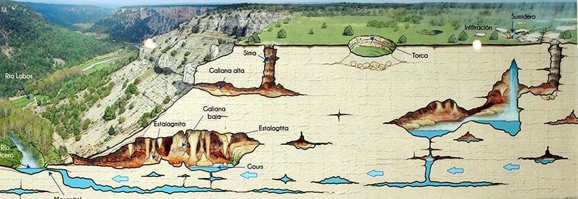
And it is that the whole landscape is of karstic earth so it is what is said to be porous and therefore prone to being soft earth. Because of that there are many caves and a whole underground water system. Flora and fauna take advantage of these wonders.
There are pines, holm oaks, junipers, poplars, willows, poplars and water lilies or eneas on the waters. In the other hand there is vultures, owls, eagles, hawks, trout and otters, just to name the most important species.
Tourism in the Cañón del Río Lobo Natural Park
With such a description, surely you already want to go spend a few hours here. And you can do it, tourism comes from all over Spain accessing the park from three different points: you can enter from Burgos, from the town of Hontoria del Pilar, to the west; also from the access Seven Eyes Bridge, the most used when hiking; and also by the end of the canyon where the entrance known as The Galiana, near the Interpretation Center and therefore also very used.
You enter where you enter there are information centers, services and parking. Maybe so many hiking trails overwhelm you, in fact you can spend more than hours here in days, so you can start with make a basic visit that includes knowing the Hermitage of San Bartolomé and the Miradas de la Galiana.
This is a very simple walk what is done in a couple hours So let's say it is suitable for all audiences. This visit Then start at the Casa del Parque Visitor Center, in Ucero. Then you enter through the entrance that is at the foot of the Galiana slope and from that point the views are incredible. If you go by car, you can go two and a half kilometers along a paved road and then park in any of the three available areas.
One car park is in Fuente Engómez and the other two are in Cueva Fría, just a kilometer and steps away and the other in Valdecea, two and a half kilometers away. If you go for these dates you will not be able to go further with the car than the Cold Cave. If you leave the car in Valdacea you have a thousand meters to the esplanade of the hermitage of San Bartolomé. To get there you have two paths to choose from.
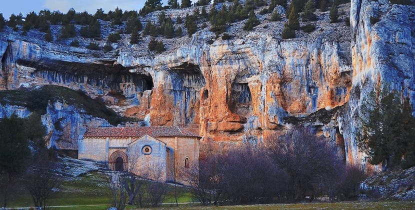
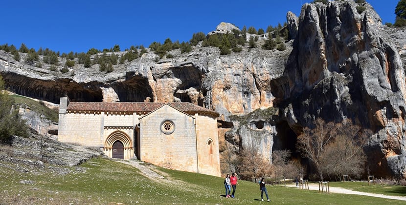
You can go along the so-called River Path, crossing the river jumping stones, or follow the forest track, ideal if you wear sandals or do not want to exert yourself. The place where the hermitage is seems magical, in a meander of the river, with ponds with water lilies, between orange stone walls. The construction is in a romantic style, XII century, and has a beautiful five-pointed rosette. Open only at certain times.
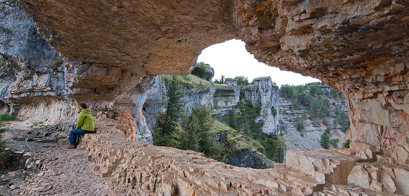
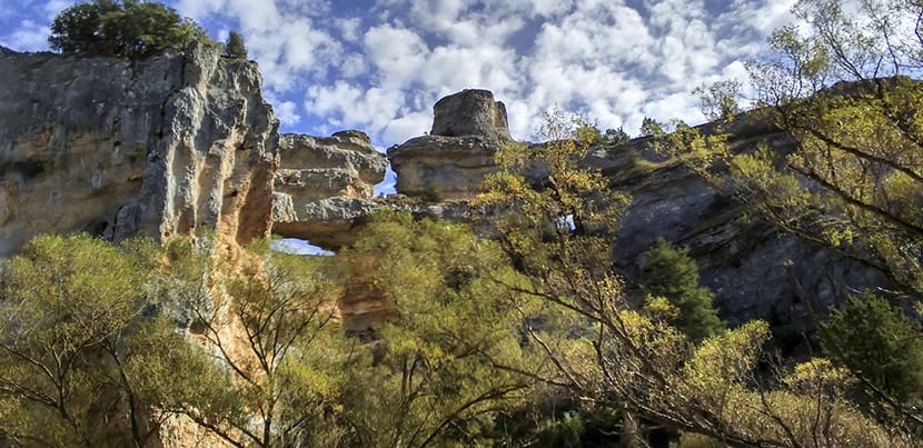
The basic visit continues to the Cueva Grande and the Balconcillo. The Big Cave is a large hole in the limestone decorated with paintings, there near the hermitage. Also next to it there is a path that goes up to the Balconcillo, a natural window that provides phenomenal views of the canyon. Do not miss it. And here, if you have more energy, you can continue a little further along the River Path, to see how the canyon narrows and reach the Apiary of the Friars.
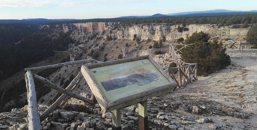
There are old, traditional beehives here, on ledges in turn placed on the rock. But not only that, there are also shelves with frogs, many, and water lilies. A beautiful site. The basic visit ends here. When you get back to the car you can drive a little to the Galiana viewpointIt will be three kilometers, to enjoy a very good view of the canyon, Ucero and its castle and more mountains in the background, flown over by vultures.
Now if yours is the very easy Properly speaking, as I told you, the park abounds in paths and routes and some are specially marked and marked out. There are many, but basically we can concentrate everything on four paths that cross the best areas of the park:
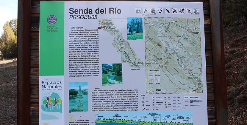
- River Path: it makes a linear path through the riverbed of the Lobo, 15 kilometers one way, and has several sections. It goes from one end of the park to the other and you can also take it from the middle, at the Bridge of the Seven Eyes. It is a flat path, not difficult at all.
- Castle Path: It is a circular path of 6 kilometers and does not pass through the central axis of the canyon. The route includes the castle of Ucero, the town itself, and a Roman tunnel of more than one hundred meters. You can take the route at any point but it is best to start it at the Casa del Parque and take the brochure with information. The castle is free to enter and has great views. Calculate a few hours.
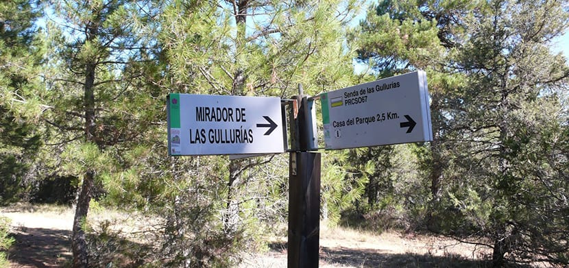
- Path of the Gullurías: It is also a circular route but it runs for nine kilometers, with the departure and arrival at the Casa del Parque de Ucero. The landmark of the route is the Mirador de las Gullerías, with a phenomenal view of the place.
- Path of Hontoria: another 10 kilometer long circular path. It runs through the first section of the canyon, lower, with dense pine forests, which makes it a more intimate and almost secret path.
As we said before, the truth is that the Cañón del Río Lobos Natural Park has many paths, known and traveled, and not so much. Between them and just by not leaving them out we can name the routes of Pico Navas, La Sierra, Valdecea, El Encnar de Nafría, El Torcón, Río Chico or Valderrueda. And don't forget the caves!